
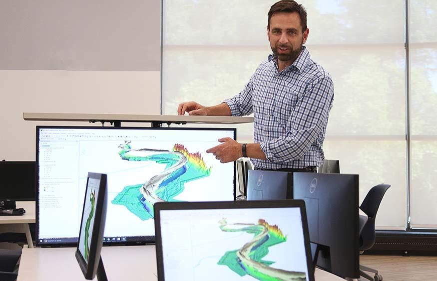
Dr. Reuben Heine explains the GIS project that provides a 3D visualization of 60 years of sand deposits in the lower Mississippi River near Baton Rouge, La. Augustana's geography department has teamed up with researchers at Louisiana State University and Rice University on a multi-year funded project to better understand the impact of sedimentation on Mississippi River flooding. Augustana is providing all of the GIS data and analysis for this project.
GIS: ‘A powerful tool for analyzing the world’
Augustana considers a minor in geospatial science — GPS, remote sensing, drone mapping
As Augustana College follows the growth curve of new technologies, geospatial science is on the drawing board as a possible new minor. The field has grown alongside the widespread application of geospatial technology, which is used in everything from GPS navigation, to wildlife and forestry management, to tracking the current COVID-19 pandemic.
"There's been a steady rise since the 1980s, which has now turned into exponential growth in jobs and the demand for this technology," said Dr. Reuben Heine, geography professor. "When you look at the location services of smartphones, you can see the digital maps that have become part of our everyday lives, and behind all of these services are geospatial technologies such as GPS, remote sensing, and more recently, drone mapping."
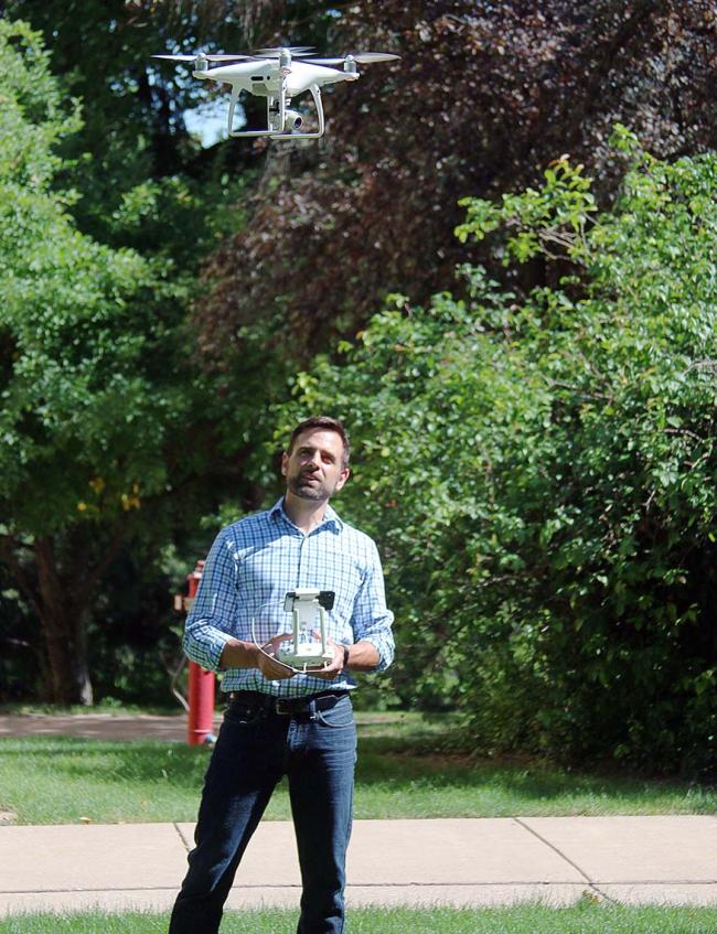
Using a process called photogrammetry, Augustana's geography department uses drone technology to create centimeter-resolution aerial photographs and topographic models.
GIS (geographic information system) technology is used to find relationships and trends in data. GIS allows data to be presented visually as maps, reports and charts. The technology can be applied to virtually anything that has a location, whether a person, object or event. Even public opinion varies by location, creating a map. And whatever can be mapped can be overlaid with additional maps to give it additional meaning.
It can reveal the best place to put a new business or a new bike trail, or to build a better healthcare network. Equally impressive, GIS can be applied on a local, regional or even global scale.
Dr. Heine currently is leading a team of Augustana students, working remotely from their homes this summer, on a GIS project funded by the U.S. Fish and Wildlife Service (FWS). Drawing from hundreds of data sources, the students are creating detailed digital maps of wildlife habitats to identify the best ones to protect a dozen endangered species.
After creating the database, the students will train FWS staff in using it, both for species protection and habitat restoration. This is critical information, and the students are being paid as research assistants for the project.
Alumni using GIS see no limits
Gus Benson '18 majored in environmental studies with minors in political science and geography at Augustana, where he was introduced to GIS. He works as a GIS analyst for the Bi-State Regional Commission in Rock Island.
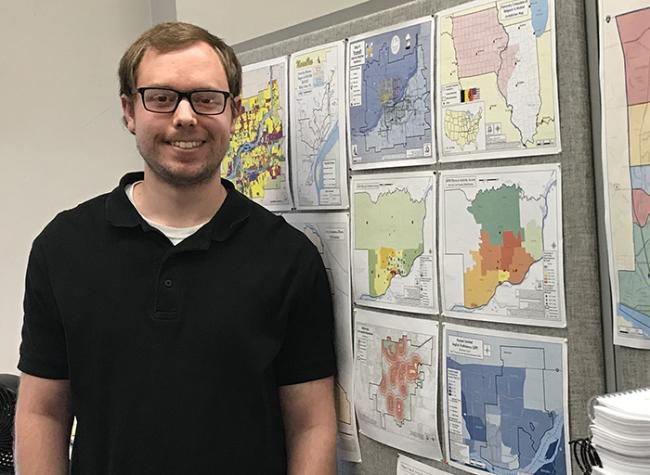
"You can do anything with this," he said. "There's always something new. Every day is different."
In the past week, he produced a map on "environmental justice" using GIS. “I used socioeconomic data overlaid with public access to bike paths, trails and recreational opportunities,” he said. “I wanted to see how income, poverty and other demographic data relate to quality of life from an environmental standpoint.”
Benson also has produced transit maps for the City of Muscatine, Iowa, accessible via smartphone. “There’s no limits,” he said. “It’s such a powerful tool for analyzing the world around us…it’ll just continue to expand.”
Barrie Chileen '17 majored in environmental studies and geography at Augustana, then earned her master's in geography at Kansas State University with a graduate certificate in GIS. She returned to Rock Island to work as a geographer with the Army Corps of Engineers; she also taught a J-term class in GIS at Augustana last January.
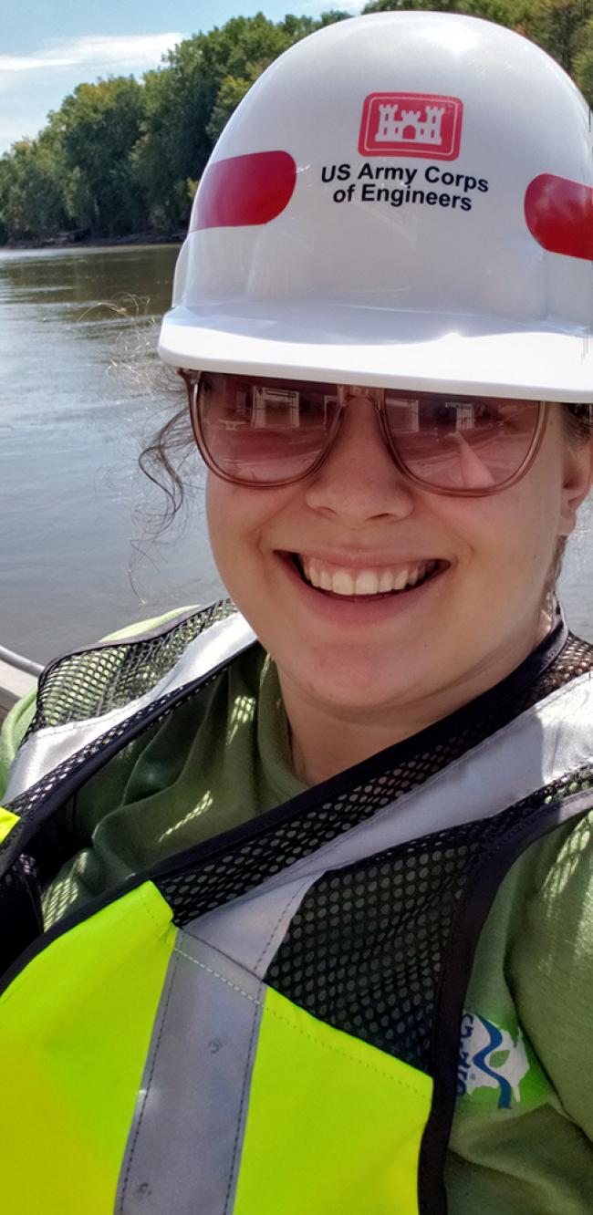
Chileen currently is using sonar to map the bottom of the Mississippi River, where the sediment is always moving, and then converts the data into depth charts used by the Coast Guard and the barge industry to navigate the river safely.
It's rewarding work, she says, but the real surprise has been the scope of GIS activities within the Corps nationally, including an emergency response team that responds to disasters. "I'd love to get involved with that," Chileen said.
Most recently, the team was dispatched to help track the COVID-19 virus, using GIS to find the best locations for temporary hospitals. The Corps also hires archeologists who use GIS in their work.
GIS complements many majors
Augustana’s proposed minor in geospatial science will be open to any student on campus, regardless of major. Nearly all fields now involve the collection and analysis of data: public health, business, sociology, political science.
Dr. Heine points to the college's new major in data analytics as a perfect companion to GIS. Both can be applied to almost any subject and have experienced high demand and extraordinary growth.
This kind of technology, within the liberal arts focus at Augustana, also presents many opportunities for vocation. "This is deeply meaningful to different communities, at all different levels," Dr. Heine said. "At its core, GIS provides a framework for analyzing spatial data and applying critical thinking skills.
"So, if you're interested in sustainability, you can find the optimal locations to put solar panels or wind farms, or map water resources and human populations, or the location of potential urban farms."
Both Chileen and Benson are excited by their work and agree it’s full of potential.
"I'm really happy Augie is moving in this direction," said Chileen. "It's only going to open more doors for future graduates. Especially with what's going on with COVID, it's been highlighting the power of geospatial technology even more. We're all looking at maps now."
Augustana has two geospatial labs, including one in the new addition to Hanson Hall of Science, and all faculty in geography have GIS backgrounds. Dr. Heine currently is writing the proposal for the new minor, which ultimately is voted on by all faculty before it can be offered to students in the fall of 2021.